Cemetery Maps
The Valley Rico Cemetery is located on both sides of Highway 145, just south of Rico, Colorado.
To provide you with more detailed information, we’ve included several maps: a comprehensive overview map that links to a high-resolution image (to the immediate right), and three separate, more detailed maps focusing on plot areas, veteran plots, and reserved plots.
We’re currently working on enhancing these maps by making them clickable, allowing you to access additional information about the individuals interred in each plot.

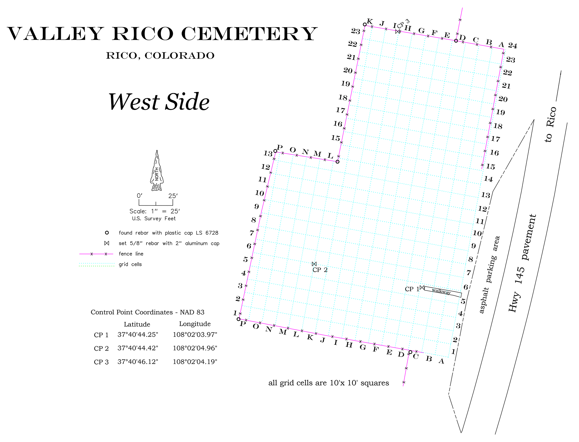
West Side Map
This map shows the West Side Cemetery in more detail; burial plots are marked. Click on a square or circle below for a list of individuals buried in that plot. Each listed name then clicks through to their individual deceased page with more information.
West Side, Valley Rico Cemetery
West, A10
West, B1
West, B2
West, B4
West, B5
West, B9
West, B10
Obendorfer, Henry A
West, B21
West, B22
West, C9
West, D1
Clark, James C (Conway) - Veteran
West, D2
West, D10
West, D11
West, D12
West, E8
West, E12
West, E13
West, E17
West, E19
West, F1
West, F9
West, G8
West, G10
West, G14
West, G16
West, G20
West, G21
West, G22
West, H10
Baer, Charlie (Veteran)
Baer, Edward C (Veteran)
West, H11
West, H14
West, H15
Weset, I8
West, I9
West, I22
Parsons, W. E (Veteran)
West, I23
McCormick, S. W (Veteran)
West, J17
West, J20
West, J23
West, K6
Swank, James Eldon (Veteran)
West, K8
Kennedy, David T (Veteran)
West, L5
West, L6
West, L8
Steinhauser, Adolf (Veteran)
West, L12
West, N12
West, N13
West, O10
West, O11
West, Unknown
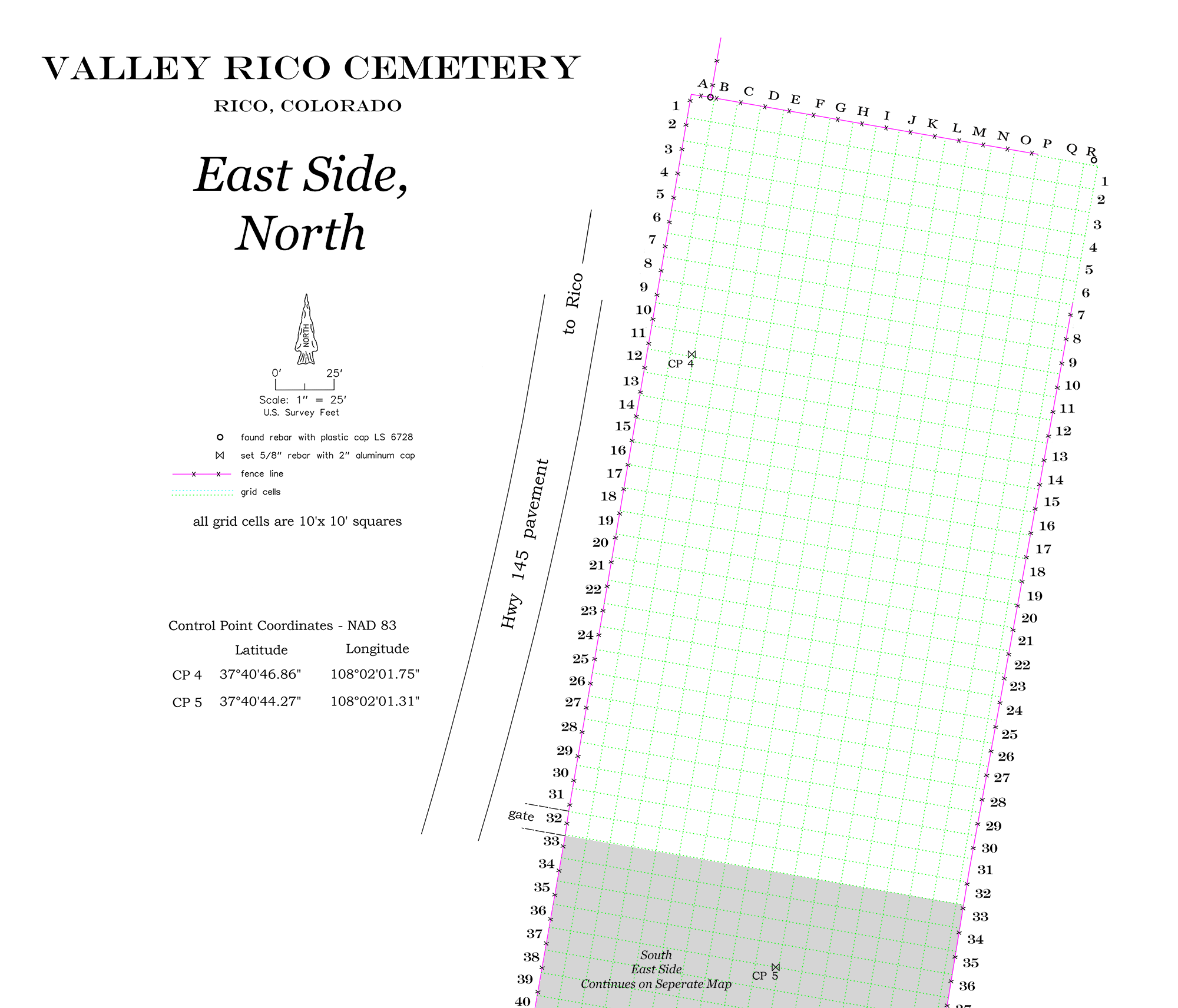
East Side Map, North
This map shows the East Side Cemetery, North in more detail; burial plots are marked. We are working now to make these clickable, for further information about each deceased.
East Side, North
East Side, North - C29
East Side, North - C30
East Side, North - D03
East Side, North - D04
East Side, North - D12
East Side, North - D29
East Side, North - D30
Mangold, Ralph Girard (Veteran)
East Side, North- D31
East Side, North - E03
East Side, North - E07
East Side, North - E12
East Side, North - E14
Colombo, Jennie
Colombo, Robert J (Veteran)
East Side, North - E15
East Side, North - E16
East Side, North - E17
East Side, North - E18
East Side, North - E19
East Side, North - E30
East Side, North - F07
East Side, North - F24
East Side, North - G08
East Side, North - G14
East Side, North - H02
East Side, North - H05
East Side, North - H06
East Side, North - H12
East Side, North - H14
East Side, North - H20
East Side, North - H22
East Side, North - H27
East Side, North - I11
East Side, North - I16
East Side, North - I17
East Side, North - I18
East Side, North - I24
East Side, North - I27
East Side, North - J13
East Side, North - J14
East Side, North - J17
East Side, North - J19
Gardner, Richard Lee (Veteran)
East Side, North - J20
East Side, North - K13
Welihan, Stephen (Veteran)
East Side, North - K19
East Side, North - K20
East Side, North - K31
East Side, North - L10
East Side, North - L18
East Side, North - L19
East Side, North - M22
East Side, North - D30
East Side, North - M25
East Side, North - M29
East Side, North - M31
East Side, North - O10
East Side, North - O12
Stampfel, Frank J (Veteran)
East Side, North - O13
East Side, North - O14
East Side, North - O23
East Side, North - Q10
East Side, North - Q15
East Side, North - Q16
East Side, North - Q18
East Side, North - Q19
East Side, North - Q21
East Side, North - Q22
East Side, North - Q29
East Side, North - Unknown
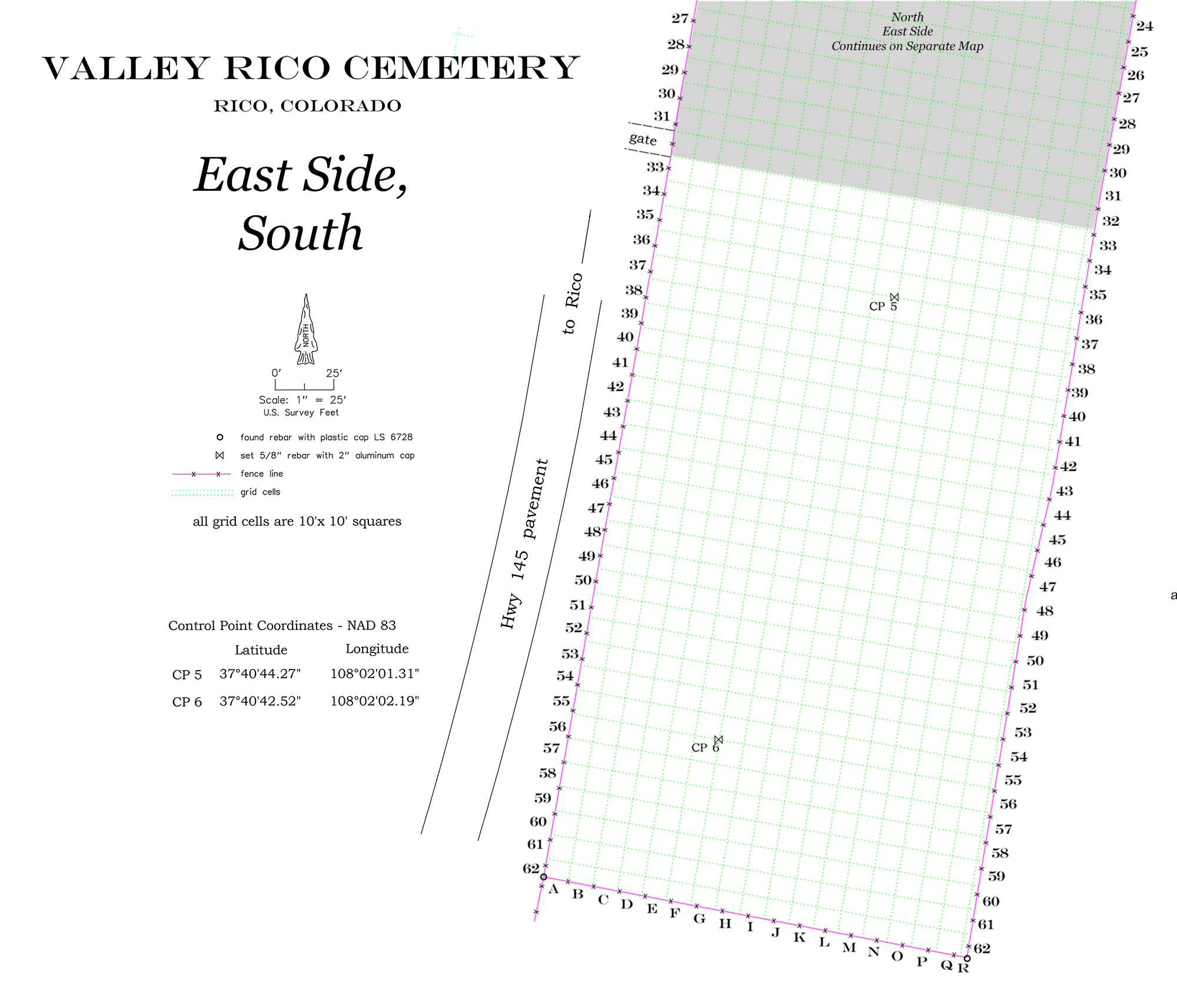
East Side Map, South
This map shows the East Side Cemetery, South in more detail; burial plots are marked. Click on a square or circle below for a list of individuals buried in that plot. Each listed name then clicks through to their individual deceased page with more information.
East Side, South
East Side - South, B62
East Side - South, C41
East Side - South, C43
East Side - South, C50
East Side - South, C59
East Side - South, C60
East Side - South, D35
East Side - South, D37
East Side - South, D38
Towne, Michael O (Veteran)
East Side - South, D39
East Side, South - D40
East Side, South - D49
East Side, South - D58
East Side, South - D59
East Side, South E47
East Side, South - G39
East Side, South - G45
East Side, South - G48
East Side, South - G49
East Side, South - G58
East Side, South - G59
East Side, South - H45
East Side, South - H48
East Side, South - H52
East Side, South - I45
Lingol, Elmer J
Lingol, Eugene Elmer (Veteran)
East Side, South - J48
East Side, South - J49
East Side, South - J50
East Side, South - J61
East Side, South - K57
East Side, South - K58
East Side, South - K59
Melvin, Don Clayton
Melvin, Shari Roxann
East Side, South - K59
East Side, South - L56
East Side, South - L57
East Side, South - L61
East Side, South - M48
East Side, South - M49
East Side, South - M50
East Side, South - M51
East Side, South - M52
East Side, South - N36
East Side, South - N37
East Side, South - N50
East Side, South - N51
East Side, South - N52
East Side, South - N58
East Side, South - N60
Lill, Ernest Martin (Veteran)